Malian herders adapt to climate using satellites
The consequences of climate change are affecting farmers in Africa. To help livestock farmers and herders adapt to climate events, the Sustainable Technology Adaptation for Mali Pastoralists (STAMP) project set up the Garbal service. It aims to improve access to and the use of both satellite and ground-based geographic data. The service turns the collected information into farming advice, which is tailored to the farmers’ needs. Farmers can then call or text to get the information. For herders in the Sahel region in Africa, this information can be the difference between life and death for their cattle. Since its launch in 2015, the Garbal service has recorded over a thousand calls and 84,000 text message requests from more than 55,000 users.
")
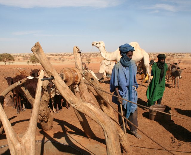
Mr Halidou and a collector from Tassaght
Losing fewer animals
Kadji is a riverside village on the western side of the Niger River, 15 km from the city of Gao. Netherlands Development Organisation (SNV) Mali's STAMP project has been working there with local farmers since 2015. The farmers used to pay very little attention to food and water for their animals. They only thought about food and water when travelling long distances by donkey or camel, or when they needed to travel with their herds. Many of the animals died this way. Mr Djibilla Halidou, a 48-year-old farmer, is very happy with the Garbal service. “Thanks to the Garbal service, fewer animals have died because we now know where we are headed. Garbal has allowed me to save money compared to previous years. We have noticed a change in the way the livestock farmers work here in Kadji, especially on a social level. Garbal gives us access to fast and reliable information, meaning that we have time to focus on other tasks."
Malian herders
Knowing the market value of livestock
Djebock is a village 45 km north-east of the city of Gao. Its main economic activity is livestock breeding and agriculture. Mr Albacher AG Goubaye is a 40-year-old farmer who sells livestock. He uses the Garbal service to get useful information about the market value of livestock.
“Before the Garbal service was made available in 2015, I used to sell my livestock with no idea about what it was worth. This had a big impact on my income. With only 50 West African CFA Francs of credit, I can use Garbal to find out the market value of my livestock. This puts me in a good position before I go to the market. Garbal also means I do not have to travel and spend money searching for grazing information. I can get all the information on grazing, water sources, market prices and the concentration of livestock in certain areas in a few minutes.”
According to SNV, the consequences of climate change and insecurity are affecting pastoralists’ mobility. Their traditional means to search for natural resources and decide on their migration, are made uncertain, expensive and risky. However, livestock mobility in arid areas is essential for their survival, and is a key feature in pastoralists’ food security.
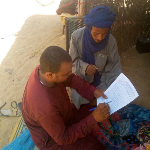
Mr Albacher AG Goubaye with a collector from Tassaght
Geodata for Agriculture and Water (G4AW)
The STAMP project was funded by the Geodata for Agriculture and Water (G4AW) subsidy programme. The Netherlands Space Office (NSO) carried it out on behalf of the Dutch Ministry of Foreign Affairs. As agreed in the Paris Climate Agreement, the Netherlands supports developing countries in combating climate change. The Netherlands’ climate efforts focus in particular on accelerating the energy transition, combating deforestation, improved water management and climate-smart agriculture. The STAMP project is active in Mali. It is carried out in partnership with Orange Mali, Dutch company Hoefsloot Spatial Solutions, Tassaght, the Ministry of Livestock and Fishing and the Malian Ministry of Digital Economy and Development. SNV created the service and coordinates the project.