New profession in Burundi: Rain Master
The Good Agricultural Practices for all (GAP4ALL) project offers circa 100,000 farmers in Burundi a suite of agricultural services that they can use to significantly increase their production and income. The first success has come from a local weather information application. GAP4ALL is part of the Geodata for Agriculture and Water (G4AW) programme, which NSO coordinates.

Photo by Weather impact
We all do it without a second thought: consult a precipitation radar. In Burundi, however, there is little point in doing so, because the local meteorological department has to make to do with very limited weather data. The first task as part of the GAP4ALL project was therefore to develop a good weather information application for small-scale farmers (i.e. circa 90% of the local population). Dozens of towns now have a tablet that gives people access to the AgriCoach app. The information in this app is presented using symbols (since not everyone can read), as text (in French, English and Kirundi) and in the form of a diagram, which visualises the chance of rain. At the moment, this service benefits 20,000 farmers, but the goal is to quintuple that number by the end of 2020. In every community, a "rain master” is responsible for managing the application.
Rain information is paramount
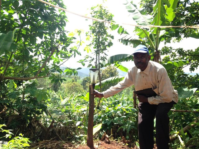
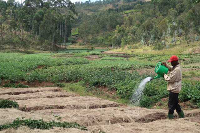
One of them is Celeus Bakoma. Every morning, he consults the app and then shares his findings with around fifty of his neighbours - called the G50 - who are working together to take their agricultural efforts to the next level. Rain information is the most important component of the information service, because it allows the farmers to make better and more informed decisions. Earlier this year, for example, Bakoma delayed the planting of seeds by two weeks. The weather during the first week was too dry, while the second week was too wet. He says the app is circa 85% accurate and is convinced of its usefulness: “Every farmer in Burundi needs this.” One thing people would like to know is when the rain is expected to fall: in the morning or in the afternoon? If heavy rain is predicted, people can start digging drainage canals in a timely manner.
Telesphore Nabomenyereye is the rain chief in a different town. Once again, the G50 is convinced that having access to more accurate weather information leads to improved crop yields and higher profits. As many farmers as possible from other settlements are invited to check the service out for themselves. “It will change their lives. Last year, for example, we would not have planted our corn too soon if we had known that the rain season would start a bit later.” What the people in this town want most is information about storms and lightning. If strong winds are expected, they can cut the leaves off banana trees on time to prevent the trees from snapping.
A bit further on in Burundi, rain master Fabien Mariatunga's internet connection is spotty, but usually available in the mornings. The rain forecast now determines the day's entire activity schedule. For example, he once cancelled the hiring of land workers because rain was expected. "That saved me a lot of money.” Like most farmers, he hardly ever uses the temperature information that the app provides. “The temperature is less important in the tropics, because most days are just as hot as the day before,” says dr. Stefan Ligtenberg, project leader at Weather Impact, one of the five Dutch organisations that develop services as part of the GAP4ALL consortium (out of a total of eight organisations).

Photo by Weaterimpact
Probability
Around the equator, slow temperature fluctuations and oceanic currents govern the weather. Ligtenberg: “Perhaps we can do something about the farmers’ unanimous request to provide rain predictions for an entire season. At the moment, we are using historical data to determine whether the results for Burundi would be reliable at all.”
Each rain master has been asked to report back via their tablet how many millimetres of rain actually fell that day, using the rain gauge they were given for that purpose. “Almost everyone does so reliably,” Stefan Ligtenberg concludes. Weather Impact then uses the data to calibrate its models. At the same time, the farmers learn what it means when the diagram indicates a certain probability of rain.
“Medium-term predictions would also help to incorporate partially failed harvests in the planning: a longer period of drought means more reserves or different crops have to be planted. Another example is combining satellite data with geoinformation analyses in new ways, which let us warn about local erosion risks or excessive deforestation,” says Cornelis Heesbeen, CEO of Auxfin, the overall project leader. “Long-term sustainability is just as important in Burundi as the hunger and extreme poverty of today. Whereas farmers in the Netherlands spread sixty tons of fertiliser on a hectare of land, even a fifth of that would be a significant improvement in terms of the balance between a healthy soil, income security and food production in Burundi.”
All-inclusive
In addition to weather information, the farmers will soon also receive cultivation advice via the AgriCoach app. As a G50, they are aided in choosing crops that are best suited to the local soil conditions, while also leaving some room for personal preferences. Furthermore, activity calendars will become available for more than thirty different crops, which let farmers know exactly what needs to be done that week. These calendars are complemented by simple instruction videos and advice on how to carry out the necessary activities in accordance with Burundian best practices.
Reaching as many farmers as possible during the early years of the project is not the only reason for Auxfin to work with groups of fifty farmers. “It is also part of our all-inclusive approach,” Cornelis Heesbeen emphasises. “It is as much about activating entire communities as it is about attention for all relevant aspects: finances, work and income, health, education, social cohesion and self-reliance and governance. With many aid projects, the most disadvantaged members of a community enjoy little to no benefits. As a result, the inequality in a settlement will have exacerbated by the time a project comes to an end. The G50 approach ensures communities benefit as a whole.” In two years’ time, GAP4ALL must have proven its added value to local farmers and the service will transition to a subscription model.