STAMP
Garbal Sustainable Technology Adaptation for Mali's pastoralists
> Download the STAMP project closure flyer
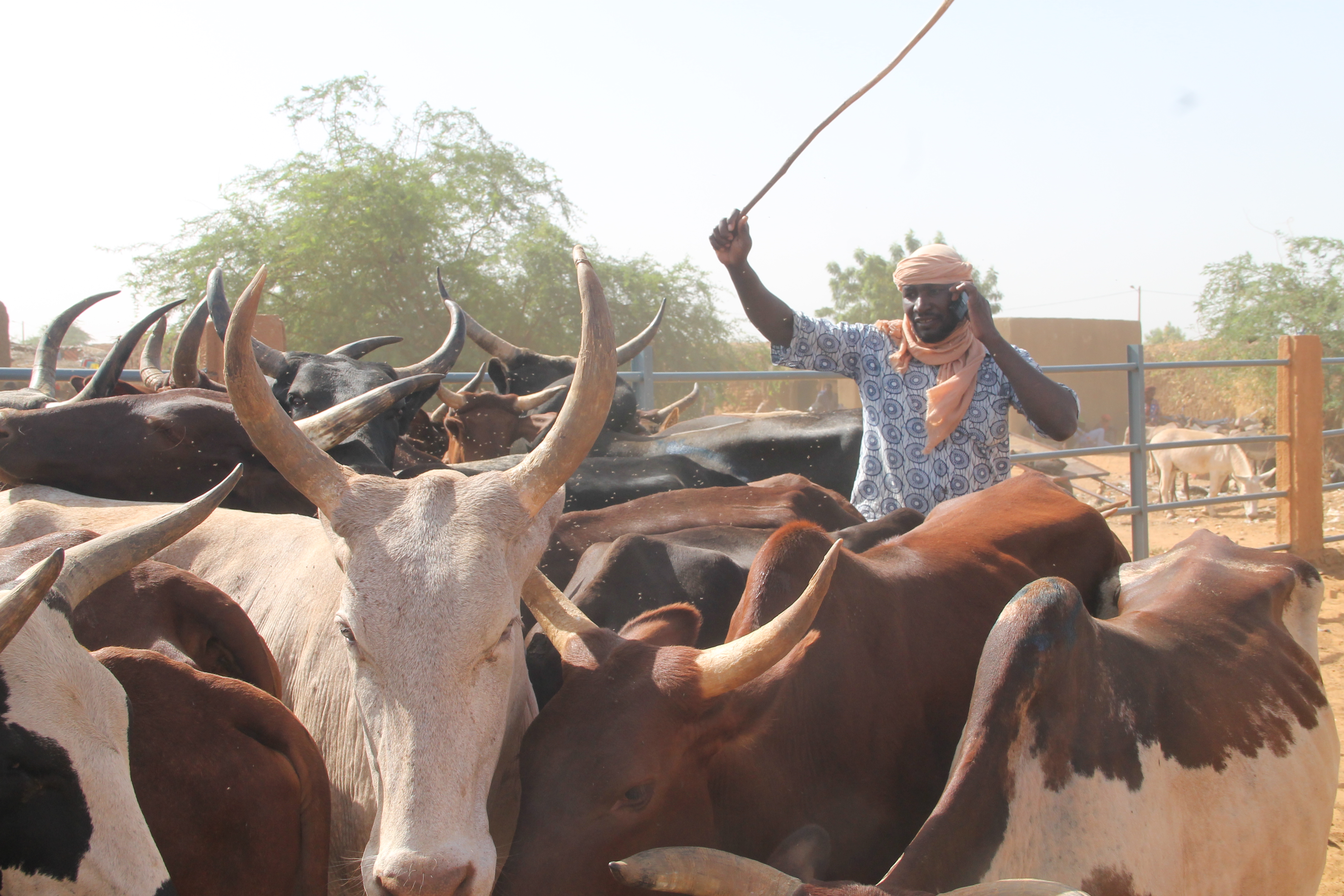
The STAMP (Sustainable Technology Adaptation for Mali’s Pastoralists) project aims to improve resilience among pastoralists affected by climate change, through access to and use of data derived from satellites. The result is a service that is tailor-made for pastoralists’ information- and decision making needs, giving them a predictive analytics tool for guiding their movements. Subscribers receive the information via a call centre.
The project was carried out by SNV Netherlands Development Organisation (Mali), Action Against Hunger (an NGO from Spain), Institut d’Economie Rurale (Mali), ORANGE Mali (a telecom provider), Tassaght (an NGO from Mali), Project Concern International (a development organisation with headquarters in the US) and Hoefsloot Spatial Solutions (a remote sensing company based in the Netherlands).
Provided services
The idea behind the service is that a combination of indigenous knowledge and remote sensing data is a critical input for pastoralist’s migration decisions. The service package has the brand name Garbal and offers information on biomass availability, biomass quality (based on the satellite derived normalised difference vegetation index NDVI), surface water availability, herd concentration, and market prices for livestock and staple grains along the different transhumance routes.
The algorithms for Garbal process satellite and field data into advisory information. The satellite data used are Meteosat, Proba-V and Sentinel-2. During the project the resolution of the biomass and surface water data was increased to 10 metres by 10 metres. The data was enriched with participatory mapping carried out in cooperation with the communities, to exclude the cultivated zones in the grazing areas. This helps to avoid conflicts between pastoralists and sedentary farmers. The in situ data collection is a time-consuming exercise, which has to be repeated every season. An application with a web viewer was made available to the call centre operators. ORANGE Mali developed an application for collecting data by pastoralists. In addition, methodologies were designed enrich this application with indigenous knowledge of the pastoralists. The combination and quality control of the various data ensure an 98% accuracy, according to the users surveyed.
The pastoralists can access the Garbal services with simple cell phones through the call centre or they can send USSD requests. They then instantly obtain decision-making support information in their local language of choice. The STAMP project contracted data collectors, trained call operators and sales agents, and developed training material for data collection, validation and use to make the Garbal service operational and of good quality. Face-to-face meetings, word-of-mouth, social media and campaigns of another agricultural service of ORANGE Mali, called M-Agri, were used to raise awareness about the service.
Business model
ORANGE Mali is the business owner of the Garbal service. Together with other partners service provision is continued in combination with a strategy to mobilise sufficient revenue. The conditions in Mali are currently not favourable for operating the service on a commercial basis. Still, it was convincingly demonstrated that the service provides a high societal value and that the business model of charging for calls in combination with a call centre operated by a mobile network operator is sound. Without the funding of the G4AW Facility this could not have been realised, because the risks involved are too high.
Thanks to this societal relevance, STAMP received support from the Netherlands Embassy in Mali to continue and improve the service after the end of the project and to scale up to other regions in Mali. There are plans to expand the service further to other pastoralist regions in sub-Saharan Africa.
Impact
Garbal has demonstrated to be a useful service for pastoralists. Despite the limited network coverage in Mali and reduced connectivity due to conflict, 95% of users find Garbal easy to use and more than 90% reported to have made different decisions based on the information received via Garbal.
The involvement of local leaders as service ambassadors during the awareness sessions contributed greatly to the credibility of Garbal and showed the importance of word-of-mouth promotion. Addition of information on market prices helps the delivery of services throughout the year and reduces the seasonality effect of having demand only when the dry season progresses and having interest waning off during the rest of the year.
Through an excellent communication campaign STAMP got attention from international organisations and governments in the Sahel region (Benin, Cameroon, Togo, Senegal, Niger, Chad and Mauretania). The cooperation with ORANGE Mali also provides opportunities of expansion. A good example is the introduction of the Garbal service in Burkina Faso through the G4AW-project MODHEM.
Partnership
Lead organisation:
- SNV Netherlands Development Organisation, Mali
Partners:
- Action Against Hunger (ACF), Spain
- Hoefsloot Spatial Solutions (HSS), Netherlands
- Institut d’Economie Rurale (IER), Mali
- Project Concern International (PCI), USA
- ORANGE, Mali
- Tassaght, Mali
> Visit the reporting tool for project results and updates
| Country | Mali |
| Services | Location information (pastures and water)Market information |
| Crops | Fodder |
| Target groups | Pastoralist |
| Project period | 2015-2019 |