Optimizing Irrigation with SOSIA: An innovative tool based on open-source satellite data
Blog written by FutureWater. The views and opinions expressed in this blog are those of the author(s).
“How long do you irrigate per day?” we asked Madame Christine, a small-holder farmer with an eye for business. “Well, I used to irrigate for up to three hours every day, but not anymore. I can now double my fields under cultivation and sell more crops while using the same amount of water!”
We received this reaction during our field trials in Zambia for our newly developed Satellite Open-Source Irrigation Advisory (SOSIA) tool. This tool was developed within the two-stage call for innovations based on open-source geodata launched by the Netherlands Space Office (NSO), which aimed at positively impacting food security and sustainable land and water management in Africa. In response to this challenge, FutureWater and Holland Greentech developed the SOSIA tool to help small and medium farmers make informed decisions about their irrigation practices. While irrigation is a crucial aspect of agriculture, over-irrigation can lead to significant environmental problems, and it reduces profits for farmers. Using less water can lead the farmer to spend less time irrigating, having a lower electricity/fuel and water bill, improving the water productivity of crops and contributing to a sustainable environment.
What is the SOSIA tool?
SOSIA is a state-of-the-art, open source, satellite-based tool that provides both historical and near real-time information on irrigation water requirements for smallholder farmers, calculated based on open-source geodata and specific additional farmer and crop information. The tool was developed to overcome the often-limited ground data availability for calculating crop water requirements. The only data farmers can rely on are traditional weather stations, often far away from their fields. With the SOSIA tool, the farmer receives information based on open geodata for their location, by converting the spatial data into Virtual Weather Stations (VWS)!
Seasonal and hindcasted irrigation information
The SOSIA tool provides a farmer with irrigation advice, expressed in minutes of irrigation duration, throughout the crop season. Before the farmer plants the crop, an extension officer of Holland Greentech uses the SOSIA tool to provide the farmer with their tailor-made seasonal crop schedule, which is an overview of expected irrigation minutes for the rest of the season, calculated based on the average evapotranspiration of WaPOR of the 10 years.
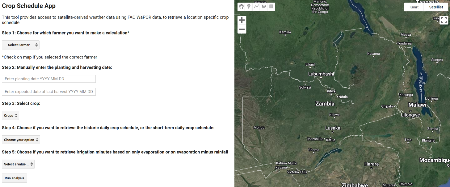
Figure 1. Grpahical User Interface of the SOSIA tool, hosten on the Google Earth Engine platform
As climate is changing, the average of the last 10 years does not always give an accurate depiction of what is happening in the field. Therefore, the SOSIA tool calculates the irrigation requirements for the last week based on open source geodata. The irrigation engineer uses this functionality on a weekly basis to make use of the actual climate data and informs the farmer only if additional irrigation is required, compared to the seasonal reference schedule.
Testing the SOSIA tool with farmers
To test the tool in the context of Sub-Saharan Africa, trials were set out in both Zambia and Rwanda with farmers from the Holland Greentech client base. The farmers were quite positive about the observed impact of using the tool. Many were surprised that the advice indicated less irrigation time than they were used to. While following the advice, the farmers also kept records of the realized number of minutes of irrigation, estimation of soil moisture and signs of drought stress. No farmer recorded any drought stress on the crops. The observations of the farmers showed that the crop performance of the SOSIA irrigated trial was visually the same as fields irrigated under their normal irrigation regime (Figure 3). The farmers were enthusiastic about this water saving, mainly because of the related decrease in electricity / fuel costs. For most of the farmers involved in the field trials, SOSIA reduced irrigation water requirements while optimizing yield.
Back to Madame Christine: she indicated that she usually irrigates her lettuce fields 1 hour in the morning and 1 hour at the end of the afternoon. She was surprised that the SOSIA advise only advised her to irrigate in the range of 50-57 minutes daily. When applying the advice, she did not notice any drought stress in her lettuce crop, and the harvest was visually the same for both the demo and control field.
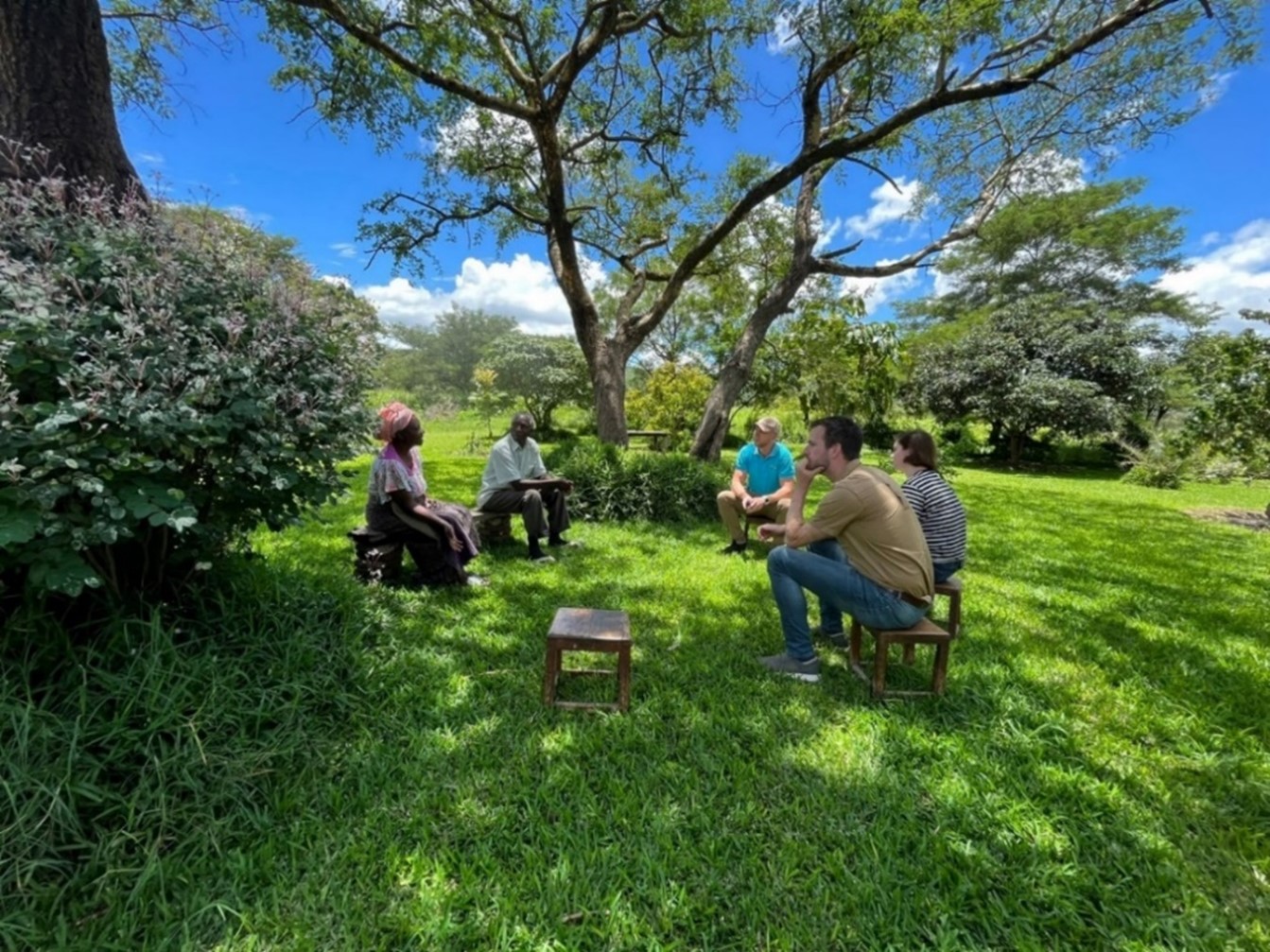 Figure 2. Conducting an interview with farmers in Zambia
Benefits for extension advisors
Extension officers are the primary intended users of the SOSIA tool on a daily basis. During the piloting phase, the extension officers from Holland Greentech received the tool with great enthusiasm. They praised the user-friendliness, quality and spatial detail of the information, and efficiency compared to traditional methods to provide advisory services.
Conclusion
In conclusion, SOSIA is a valuable tool for anyone involved in irrigation management for small and medium farmers, particularly in an African context. By providing near real-time information on irrigation water requirements, it helps farmers to irrigate more efficiently and thus to realize a more sustainable use of water resources. By leveraging the power of open source geodata, costs are kept relatively low while access to a wealth of localized information is achieved. Initial results from the Zambia and Rwanda trials indicate that application of the SOSIA tool saves farmers water, electricity/fuel, time and improves the water productivity and, potentially, income!
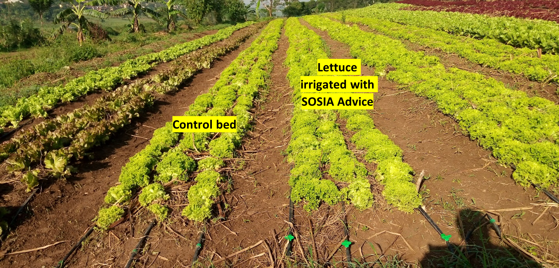
Figure 3. Differences between the SOSIA Demo and Control plot at Sunripe Farm, Rwanda (08/11/2023).

![]()